Urban Data
UPPP 214 - Week 2
Overview
Working with Urban Data
- kinds of data
- sources
- volunteered
- public
- private
- standards & formats
- importance of location
why care
using urban data
- understand what happens in the world and confidently deliver to constituents
- quantify recommendations
- facilitate conversations between diverse experts and stakeholders
- identify biases in data
- understand others’ positions and evidence to support them
kinds of data
what do we measure?
data
Tip
Don’t forget to do the reading! This is all written in a system called quarto
- travel behavior
- people and demographics
- area and proximity (geospatial measurements)
- built environment
- spatial policy boundaries (jurisdictions)
- economic behavior
- infrastructure
- weather and temperature
- land & water consumption
- preferences
- natural environment
- institutions: schools, police, fire, EMTs
- public health
- environmental conditions
- land-use
- labor markets
sources
data sources
- census (people)
- decennial
- American Community Survey (ACS)
- local government
- IRS (?())
- Bureau of Labor Statistics
- Bureau of Economic Analysis
- US Geological survey (USGS)
- dept of transportation
- dept of housing and urban development
- environmental protection agency
- NOAA national oceanic and atmospheric agency
- fish and wildlife
- CNDDB cal national diversity database (endangered species)
- CDC & CDPH
- openstreetmap
government
federal government
states
metropolitan areas
counties
municipalities
good data for california open data portal
census
FIPS codes
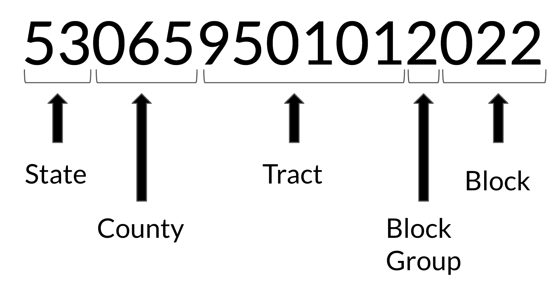
FIPS Code diagram
if i want all census tracts in OC, then i need all FIPS codes that begin with 06059
state and local data
open data
- open street map
- tweets!
- hard to verify
- biased
- bad actors (attacks?)
specifications, standards and formats
tidy data
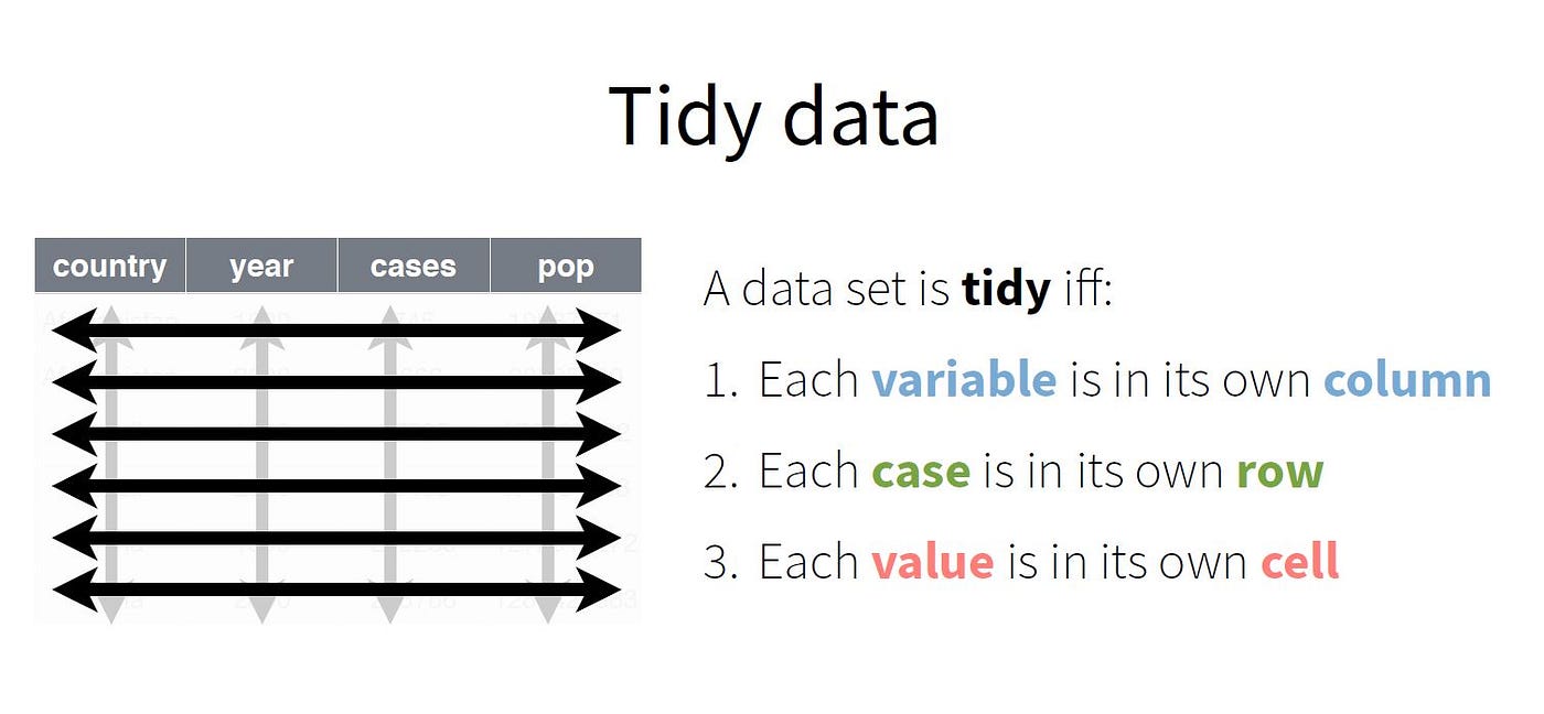
“tidy” data
standard formats
location
why is space important?
space
- data management
- visualization
- relationships
spatial primitive types
- point
- line
- polygon